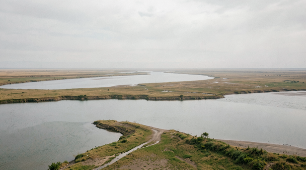
The paddy fields of Kuttanad do not sit beside the water. They sit beneath it. On the western edge of Kerala, where the Pamba, Achankovil, Manimala, and Meenachil rivers slow and spread before meeting the Vembanad Lake, the land dips to between one and two metres below sea level. Farmers here have been growing rice in that depression for centuries, not by fighting the water but by managing it with a precision that took generations to build.
How Land Ends Up Below the Sea
![Vast Delta Landscape at Dawn]()
Vast Delta Landscape at Dawn
Image credit : MyLifeXP Bureau
Kuttanad's geography is the result of two forces working against each other over a very long time. The rivers that drain the Western Ghats carry sediment as they descend. Where they slow, at the flat coastal plain, they drop that sediment, building up the bed of the lake and the land around it. Meanwhile, the Arabian Sea pushes back through the estuary, depositing its own silt and, more critically, its salt. The land that was claimed from the lake margins sits lower than the lake itself, which in turn connects to the sea. The result is a depression ringed by water on multiple sides, with gravity working against the farmer at every stage.This is not a quirk of Kuttanad. River deltas around the world produce low-lying pockets where land falls below the surrounding water table. What is unusual here is the scale at which people chose to farm it, and the sophistication of the system they built to make it work.
What a Bund Actually Does
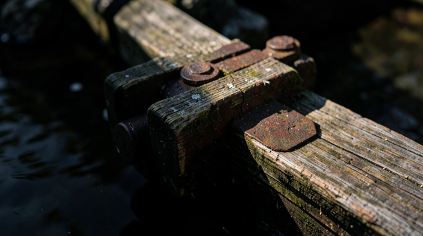
A bund is an earthen embankment, a raised wall of compacted soil that separates a cultivated field from the surrounding water. In Kuttanad, bunds are not simply field borders. They are the mechanism by which the entire farming system exists. Without them, the fields would flood permanently. With poorly maintained ones, salt water from the lake seeps in and destroys the crop.The bunds in Kuttanad are built and maintained by farming communities working in coordination. A single farmer cannot hold back the lake on one side of a field while his neighbour's bund on the adjacent plot fails. The system requires collective maintenance, and historically this was organised through community labour agreements that bound landowners and cultivators together in the work of keeping the water out.Sluice gates, locally called thura, are built into the bunds at intervals. These are the valves of the system. During the dry cultivation period, the sluices are shut to keep water out of the fields. When the crop is harvested, or when the field needs to be flushed to manage soil salinity, the sluices are opened to allow controlled drainage. The timing of opening and closing is not arbitrary. It follows the behaviour of the tides and the seasonal variation in the salinity of the lake.
The Salt Problem and How Farmers Read the Water
![Weathered Sluice Gate Mechanism]()
Weathered Sluice Gate Mechanism
Image credit : MyLifeXP Bureau
Vembanad Lake is not uniformly fresh. Its northern reaches, fed by rivers, stay relatively low in salinity through much of the year. Its southern end, closer to the sea, carries more salt. The boundary between fresh and saline water shifts with the monsoon, with the tides, and with how much rain has fallen in the catchment.For Kuttanad farmers, reading this boundary is a practical skill passed down through families. Salt water entering a rice field does not kill the crop immediately, but it raises the soil's sodium content over successive seasons until the land stops producing. Farmers who open their sluices at the wrong moment, when the lake is pushing salt rather than fresh water, damage not just one crop but the productive capacity of the soil for years.The traditional cultivation calendar in Kuttanad is built around this reality. The main crop, virippu, is planted when river inflows are highest and lake salinity is at its lowest. The timing is not fixed to a calendar date but to the actual condition of the water, which experienced farmers assess by taste, by the behaviour of fish, and by the colour and clarity of the lake at different points.
What the Thanneermukkom Barrier Changed
In the 1970s, a concrete bund was built across the Vembanad Lake at Thanneermukkom, intended to permanently separate the fresh northern waters from the saline southern reach and give Kuttanad farmers a more reliable buffer against salt intrusion. The structure exists and functions as a barrier, but its effects have been more complicated than its designers anticipated.By reducing the tidal flushing that once kept the northern lake healthy, the barrier contributed to the accumulation of water hyacinth, the silting of channels, and a decline in fish populations that the fishing communities of the lake had depended on. The salinity problem it was meant to solve persists in parts of Kuttanad because the barrier's sluices are not always operated in coordination with the farming calendar, and because the broader watershed continues to change.This is not a story of engineering failure so much as a demonstration of how tightly coupled the Kuttanad system is. A change at one point in the water network produces effects at points that were not predicted, sometimes years later.
A Landscape That Requires Attention to Stay
Kuttanad was recognised by the Food and Agriculture Organization of the United Nations as a Globally Important Agricultural Heritage System in 2013, a designation given to farming landscapes where the relationship between people, land, and water has been managed sustainably over centuries and where that knowledge remains alive in the community.What a visitor to Kuttanad sees from a boat on the backwaters, the flat green fields, the low earthen walls at the water's edge, the sluice gates rusting in the afternoon light, is the surface of a system that runs much deeper. The fields exist because the bunds hold. The bunds hold because communities maintain them. The communities maintain them because the knowledge of what happens when they don't has been handed from one generation to the next in the form of practice, not documentation.The land below sea level is not a problem that was solved once. It is a condition that is managed continuously, and the management is the culture.
Unlock insightful tips and inspiration on personal growth, productivity, and well-being. Stay motivated and updated with the latest at
My Life XP.